• Blog
  • LDS
    • Canada
    • Japan
    • U.K.
    • U.S.
    • World
    • Politicians
  • Site
    • About
    • Archive
    • Best of Rickety
    • Comments Policy
    • Copyright
    • FAQ
    • Feedback
    • Guests
    • Privacy Policy
    • Technical
    • Why Blog?
  • Sundry
    • Comics
    • HyperCheese Help
    • JFHE
    • Projects
      • Book of Mormon
    • Wishful Thinking

Rickety

Mostly about Utah

  • Family
    • Jill
    • Rick
    • Children
      • Daniel
      • Jake
      • Paul
      • Sarah
      • Steven
    • Children’s Spouses
      • Adelaide
      • Derek
      • Megan
      • Rachel
      • Shelese
    • Grandchildren
      • Aurora
      • Benjamin
      • Bryson
      • Caleb
      • Calvin
      • Cassandra
      • Elizabeth
      • Ezra
      • Helen
      • Jameson
      • Ryan
      • Sadie
  • Finance
    • Bank Rewards Checking
    • Credit Union Rewards Checking
    • Debt
    • Employment
    • Money
    • Rewards Checking Posts
  • Government
    • City
    • Elections
    • Federal
    • Military
    • Paul on Politics
    • Politics
    • States
    • Taxes
  • Recreation
    • Competition
    • Food
    • Fun in Utah
    • Games
    • Music
    • Parade
    • Sports
    • Travel
  • Religion
    • Christmas
    • Family History
    • Jesus Christ
    • LDS
    • Marriage
    • Missionary
    • On Religion
    • Preparedness
    • Scriptures
    • Temple
  • Series
    • 100 Years Ago
    • Christmas Letter
    • Epic Excerpts
    • On Religion
    • Past Pictures
    • Daniel’s Mission
    • Jake’s Mission
    • Paul’s Mission
  • Technology
    • Applications
    • Blogging
    • Communication
    • Computer
    • Energy
    • Environment
    • How To
    • Photography
    • Population
    • Transportation

More Rocky Mountain National Park

September 12, 2010 by rickety Leave a Comment

Rocky Mountain National Park

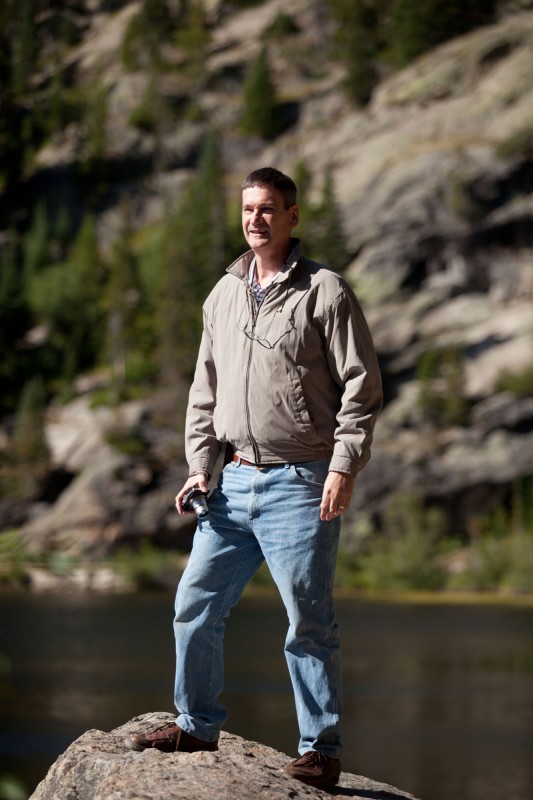
Mike walking around Bear Lake

On our second day in Rocky Mountain National Park, Mike and I traveled along Bear Lake Road to see Alberta Falls and Bear Lake. We weren’t planning on any grand hikes into the wilderness. Nevertheless we did appreciate that some areas were easily accessible with a little walking. This area of the park was busier than yesterday’s tour of Trail Ridge Road.

Rocky Mountain National Park

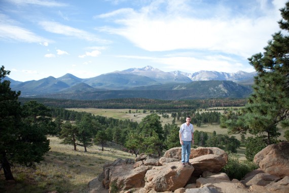
The 14,255-foot Longs Peak across this valley served as a navigational aid for centuries

Longs Peak

We took a moment to view Longs Peak, named after Major Stephen H. Long, who led a U.S. Army topographic expedition to the region in 1820. As Major Long and his party of 22 explorers neared the Rocky Mountains, he wrote, “a high Peake was plainly to be distinguished towering above all the others as far as the sight extended.”

Rocky Mountain National Park

Bear Lake sits at an elevation of 9,475 feet

Bear Lake

Bear Lake rests beneath the sheer flanks of Hallett Peak and the Continental Divide. The lake was formed during the ice age by a glacier. Several trails start from the lake. The trail around Bear Lake offers magnificent views across the lake to Longs Peak and the other high mountains surrounding Glacier Gorge.

Rocky Mountain National Park

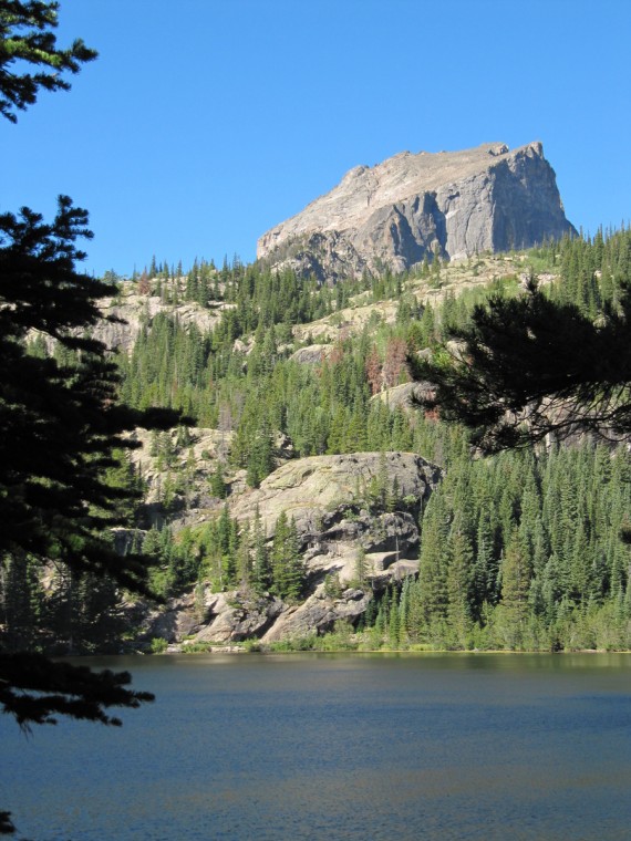
Hallett Peak viewed from Bear Lake

Hallett Peak is flanked by Flattop Mountain to the north and Otis Peak to the south. Just to its east lies Dream Lake. Non-climbers may reach the summit of Hallett Peak easily by following the Flattop Mountain Trail to its highpoint, then walking south along the ridgeline and ascending the peak over talus piles (rocks at the base of a slope). We didn’t ascent the peak but instead visited Alberta Falls.

Rocky Mountain National Park

Mike caught me enjoying the views at Bear Lake

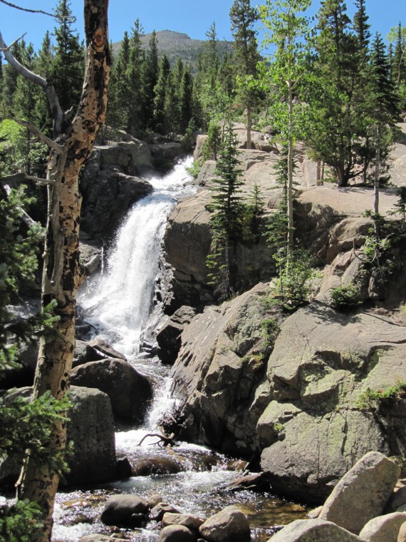
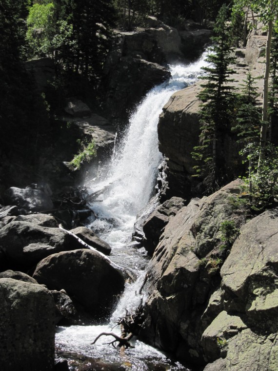
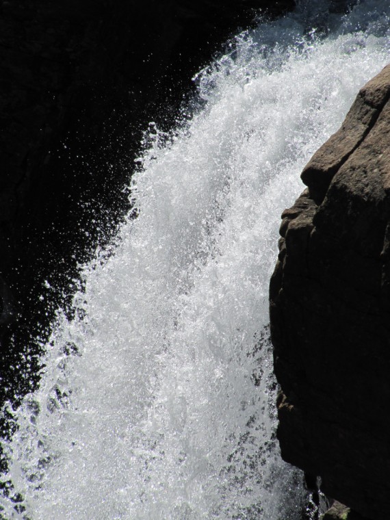
Alberta Falls

This is a very enjoyable hike. The trail is well maintained and the scenery is beautiful. The Falls are only .6 mile with a rise of 160 feet from Glacier Gorge Junction. We connected with the trail from Bear Lake. Once we viewed the Falls we doubled back on ourselves and followed the sign for Glacier Gorge Junction. We went downhill to the shuttle bus stop. We then rode back to the Bear Lake parking lot to pick up our car.

In the afternoon we headed for Utah via Trail Ridge Road. We enjoyed our time at Rocky Mountain National Park.

Rocky Mountain National Park

Wilderness

In 2009, Congress protected 95 percent of the park under the 1964 Wilderness Act. Road corridors and adjacent visitor use areas are excluded. Wilderness designation protects forever the land’s wilderness character and natural conditions, opportunities for solitude and primitive recreation, and scientific, educational, and historical values. In wilderness, people can sense being a part of the whole community of life on Earth. Preserving wilderness shows restraint and humility, and benefits generations to come. (Roaming the Rockies, NPS)
Rickety signature.

Filed Under: Mike, Recreation, Rick, Rickety Picks, Travel Tagged With: Colorado

Rocky Mountain National Park

September 12, 2010 by rickety 2 Comments

Rocky Mountain National Park

Rocky Mountain National Park is one of over 390 parks in the National Park System

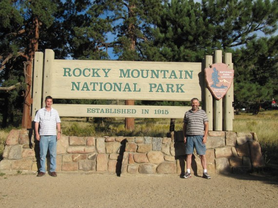
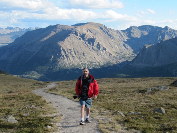
My brother and I passed through Rocky Mountain National Park on our way back home to Utah. I want to share with you a few of the photographs we took and information about the park taken from the map that is given to park visitors.

Rocky Mountain National Park

Trail Ridge Road rises to 12,183 feet, the highest major highway in North America

Trail Ridge Road

Set in the Southern Rockies, Rocky Mountain national Park could be called “the top of the world for everybody.” Here treeline and tundra –the miniaturized alpine world — are accessible to all along the park’s Trail Ridge Road. The highest major highway in North America tops out at 12,183 feet above sea level. Here is one of the the most expansive areas of alpine terrain in the United States. Nearly one third of the park is above treeline — 11,400 feet of elevation in the park — the limit above which conditions are too harsh for trees to grow.

Rocky Mountain National Park

In 2009, Congress protected 95 percent of the park under the 1964 Wilderness Act

Rocky Mountain National Park holds 72 named peaks above 12,000 feet of elevation. Longs Peak, at 14,259 feet, is the most northernmost so-called “fourteener” — peak rising above 14,000 feet — in the Rocky Mountain chain. Great Earth forces thrust the Rockies skyward 70 million years ago, but many of the exposed granite rockies in the park are much older: 1.3 billions years or more.

Rocky Mountain National Park

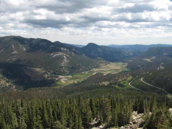
A 500-foot-thick glacier once covered the valley below.

Glacier

Three major glacial episodes from 738,000 to 13,750 years ago sculptured the scenery that inspired citizens to persuade Congress to make the national park in 1915, one year before Congress created the National Park Service. For over 30 years most of the park has been managed like designated wilderness — to preserve its natural conditions and wilderness character.

Rocky Mountain National Park

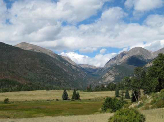
A U-shaped valley carved out by a glacier

As the valley glacier inched along over hundreds of years, it scoured out the distinctive U-shaped valley. Like a giant slow-motion conveyor belt, the glacial ice eventually carried its rock debris down the valley. At the farthest point of the glacier’s advance it deposited a load of rock fragments, called terminal moraine. About 15,000 years ago, the glacier began to recede. As it dissipated, the glacier dropped rubble along its flanks, forming lateral moraines, and the meltwater also left behind sediments that became the meadows of Horseshoe Park.

Rocky Mountain National Park

This trail led to a dead end.

Toll Memorial

The Tundra World Nature Trail of a half mile leads to the Toll Memorial. Mike and I took the wrong trail that ended in a dead end. We had to clamber up a steep slope to find the nature trail. Once on the trail at the end of the path we climbed up a rocky cleft. There was a memorial plaque commemorating Roger Wolcott Toll, the Rocky Mountain National Park superintendent from 192 to 1928 who helped Trail Ridge Road to become a reality.

Rocky Mountain National Park

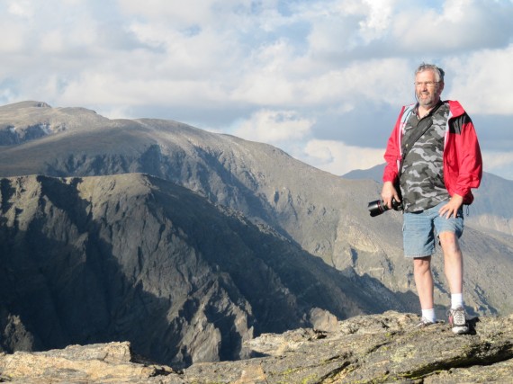
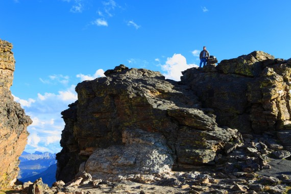
Mike took this photograph of me standing next to the Trail Ridge Mountain Index. The plaque is directly below

Climb to the top of the rock outcrop to view a grand panorama. You can use the Trail Ridge Mountain index to sight landmarks up to 60 miles away. At 12,304 feet I found the view to be magnificent.

Rocky Mountain National Park

Trail Ridge Mountain Index at 12,304 feet

Sunset

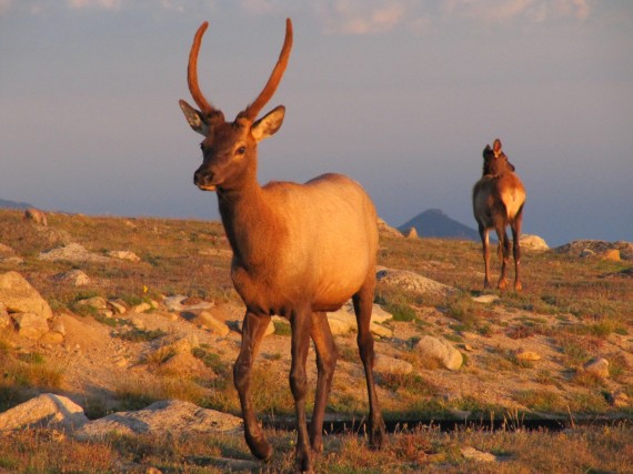
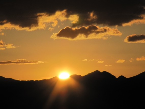
We hung around in the park until sunset. Just as the sun was going down we stumbled across a herd of elk. They were so close it was hard not to get a good photograph.

Rocky Mountain National Park

Rocky Mountain National Park

We continue our sightseeing in More Rocky Mountain National Park

Rickety signature.

Filed Under: Mike, Recreation, Rick, Rickety Picks, Travel Tagged With: Colorado

A Banner Story

July 26, 2008 by rickety Leave a Comment

Some have expressed interest in knowing the story behind the banners I display on my rickety blog. All the photographs were taking either by my wife or myself, on vacation mostly. Here are the first 18, I will post the remainder at a later date. Click on the banners below and you will see the photographs from which they were derived.

Here you can see the shuttles that brought us to the start of the trail to Angels Landing in Zion National Park, Utah. The trail ascends 1,500 feet over a distance of 2.5 miles to the summit, which is ringed on three sides by the Virgin River far below.
Angels Landing, Zion National Park

This is a fantastic view on the way to the summit of Angels Landing in Zion National Park, Utah The figure to the right is my son Steven. The remaining trail runs along a narrow rock fin with dizzying drop-offs on both sides. This narrow ridge has deep chasms on each of its flanks and hikers pull themselves up by chains.
Steven admiring the view before the last leg of Angels Landing

My brother Mike on the trail to Angels Landing, Zion National Park, Utah. We hiked for 40 minutes to reach the 1-mile mark and enter the cool shade of Refrigerator Canyon—a deep canyon with steep walls where the temperature is always cool. After exiting Refrigerator Canyon, we were upon the switchbacks known as Walter’s Wiggles—a series of twenty-one compact switchbacks that zigzag their way up to Scout Lookout.
Mike on the trail to Angels Landing

Antelope Island in Davis County, Utah, is just a few miles away from my home. Antelope Island is the perfect place to view the Great Salt Lake and experience the vast solitude of the Great Basin. The largest of the Great Salt Lake’s ten islands, visitors can reach the park by boat or via a causeway reopened in 1992 after being submerged for a decade by record-high lake levels.
Antelope Island, Davis County, Utah

Bear Lake straddles the border between Utah and Idaho. This was taken from the balcony of my brother-in-law’s cabin. Bear Lake is a large scenic lake often called “Caribbean of the Rockies” for its intense turquoise blue water.
Bear Lake from the Utah shore

Kennecott Utah Copper is the largest copper mine in the world. When I visit I am always surprised at the size of this open pit and the machinery in operation. Standing at the overlook within the Bingham Canyon Mine, you can watch 240 and 320 ton capacity haulage trucks deliver copper ore to the in-pit crusher, where the material is reduced to the size of soccer balls before being loaded onto a five-mile conveyor that carries the ore to the Copperton Concentrator.
Kennecott Utah Copper Mine

The next three photographs were taken somewhere around Bryce Canyon National Park. Famous for its unique geology of red rock spires and horseshoe-shaped amphitheaters, Bryce offers the visitor a “Far View” from the eastern edge of the Paunsaugunt Plateau in southern Utah.
Bryce Canyon National Park, Utah

With a rim elevation between 8,000 to 9,100 feet, summer days are pleasant (80’s) and nights are cool (40’s). Spring and Fall weather is highly variable with days of snow or days with strong sun and 70 degrees. Cold winter days are offset by high altitude sun and dry climate.
Bryce Canyon National Park, Utah

Because Bryce transcends 2000 feet of elevation, the park exists in three distinct climatic zones: spruce/fir forest, Ponderosa Pine forest, and Pinyon Pine/juniper forest. This diversity of habitat provides for high biodiversity. At Bryce, you can enjoy over 100 species of birds, dozens of mammals, and more than a thousand plant species.
Bryce Canyon National Park, Utah

I believe this is Lake Tahoe in California though I cannot be sure. Lake Tahoe is the second deepest lake in the United States, with a maximum depth of 1,645 feet. Tahoe is also the 16th deepest lake in the world, and the fifth deepest in average depth. It is about 22 miles long and 12 miles wide and has 72 miles of shoreline and a surface area of 191 square miles.
A lake in California

This is the same view of the lake, but a separate photograph, with a closeup of the boat that is merely a dot near the center of the banner above. Boating, the primary activity in Tahoe in the summer, is known worldwide. There are lake front restaurants all over the lake, most equipped with docks and buoys. There are all sorts of boating events, such as sailboat racing, firework shows over the lake, guided cruises, and more.
A boat on a California lake

In a corner of the southern Colorado Rocky Mountains is the Cumbres and Toltec Scenic Railroad. Built in 1880 and little changed since.
Cumbres and Toltec Scenic Railroad

My brother Mike admiring Craters of the Moon National Monument and Preserve, Idaho. Craters is a vast ocean of lava flows with scattered islands of cinder cones and sagebrush. In 1969 Apollo 14 astronauts Alan Shepard, Edgar Mitchell, Joe Engle and Eugene Cernan visited Craters of the Moon. They explored the lava landscape in order to learn the basics of volcanic geology in preparation for future trips to the moon.
Craters of the Moon National Monument and Preserve

Devils Tower rises 1267 feet above the Belle Fourche River. President Theodore Roosevelt proclaimed Devils Tower the first national monument in 1906. Our family camped at a KOA near Devils Tower and in the evening we watched Close Encounters of the Third Kind on a big screen outdoors. It was a little eerie having Devils Tower looming to my left as the movie progressed.
Devils Tower National Monument, Wyoming

Not much of a story behind this banner, just a train we saw on our way to Canada. Union Pacific Railroad, is the largest railroad in North America, covering 23 states across two-thirds of the United States.
A train on our way to Canada

My favorite destination in Florida is the Kennedy Space Center in Orlando. All Expendable Launch Vehicles use the same basic technology to get into space: two or more rocket-powered stages, which are discarded when their engine burns are complete.
NASA rocket in Florida

Jill and I stayed at the Prince of Wales Hotel in Waterton-Lakes National Park in Alberta after traveling the Going-to-the-Sun Road. This is the view from the hotel. The highlight of Waterton’s sparkling chain of lakes is the international Upper Waterton Lake, the deepest lake in the Canadian Rockies. In 1932, the park was joined with Montana’s Glacier National Park to form the Waterton-Glacier International Peace Park — a world first.
Glacier National Park, Canada

Goblin Valley State Park, Emery County, Utah was officially designated a state park on August 24, 1964. Secluded Goblin Valley was first discovered by cowboys searching for cattle. Then, in the late 1920’s, Arthur Chaffin, owner/operator of the Hite Ferry on the Colorado River, and two companions were searching for an alternate route between Green River and Cainsville. They came to a vantage point about a mile west of Goblin Valley and were awed by what they saw — five buttes and a valley of strange-shaped rock formations surrounded by a wall of eroded cliffs.
Goblin Valley State Park

Filed Under: Travel Tagged With: California, Colorado, Idaho, Utah, Vacation

Recent Comments

  • Anonymous on One Hundred Thousand Milpengo
  • Jeremy McMullin on Mesa Easter Pageant – Jesus The Christ
  • Genma Vincent on George W Bush on Religion
  • Anonymous on The Twelve Stones of The Apocalypse
  • Judy Crowe on Ten Artists Paint Old Testament Women
  • Angela on The Twelve Stones of The Apocalypse
  • Angela on The Twelve Stones of The Apocalypse
  • AllHailKingJesus on The Twelve Stones of The Apocalypse
  • Microwave guy on Make a Halloween Costume from a Microwave Oven
  • Anonymous on Arduino AVR High-Voltage Serial Programmer

Who is this Rickety?

Rick at homeI'm Rick Willoughby. I live in Utah, a retired Software Engineer. I'm a Mormon, married with 5 children and 12 grandchildren.

I emigrated from England in my late twenties, bringing with me one small suitcase and a few dollars. I appreciate the opportunities America has given me and the friendliness of the people to new citizens.

I blog about my family as well as politics, religion, finance, technology, and other topics.

Copyright © 2025 · Lifestyle Pro Theme on Genesis Framework · WordPress · Log in